Map of Amber
This page contains a map of Amber and the surrounding environs at the time of the Patternfall War by Monica (Brita).
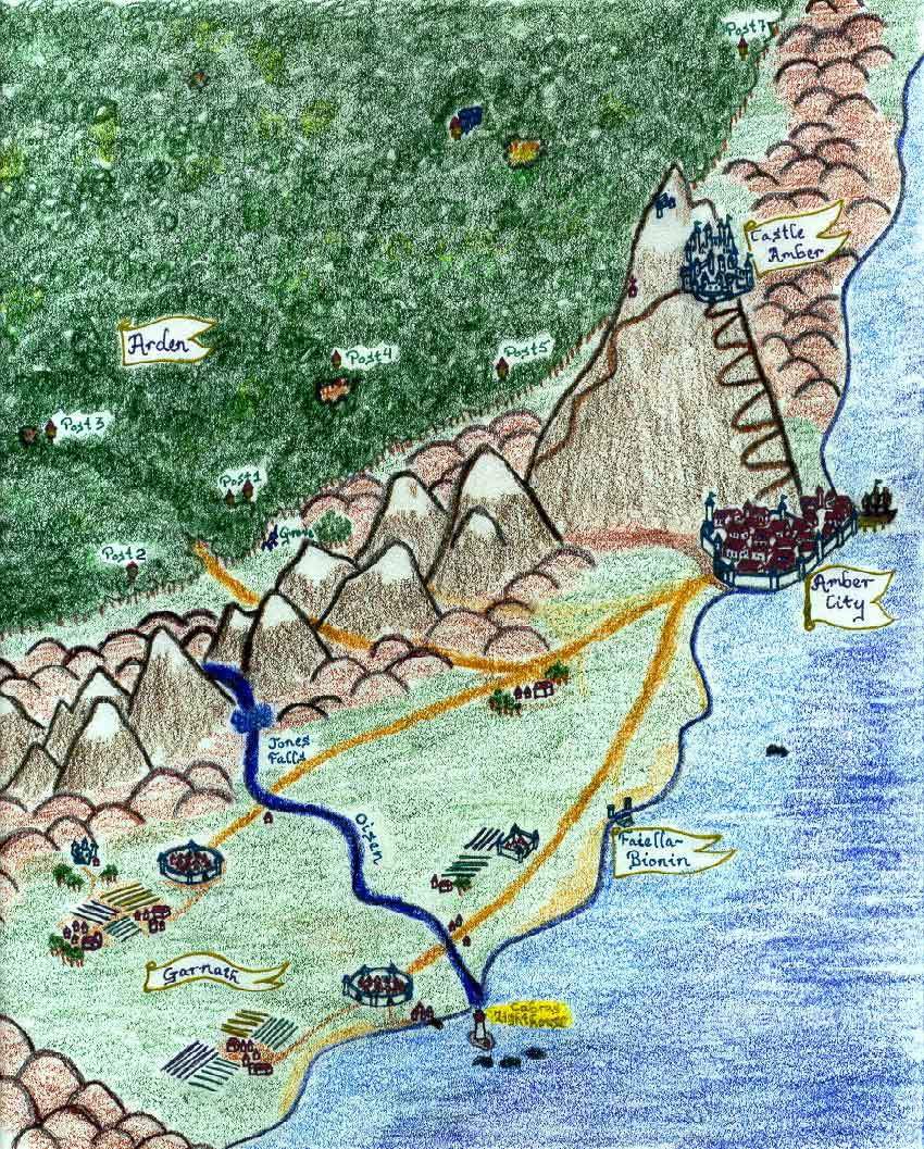
The city of Amber is at the bottom of and partway up Mt. Kolvir. The castle is about 2/3 of the way up the mountain; there are two stairways, the East and the West. The East (really northeast) stairway, the one climbed by Corwin and Bleys, is rarely used. The west (really southwest) stairway is the main access route in and out of the city, and there are side paths passable by wagons and such.
Garnath is the valley to the west and south of the city. The river passing through it is the Oisen. Jones Falls are the official head of the Oisen as it comes out of the mountains. The pass into Arden, where Benedict held off the Moonriders, is a few miles away. The lighthouse of Cabra is off the mouth of the Oisen.
The Arden-Garnath borderlands are technically in neither the valley of Garnath nor in Arden, but in the area to the west of Mt. Kolvir that encompasses the Grove of the Unicorn (marked "Grove"). Exactly where Arden begins is a subject of some debate, but a rough line for the generally-accepted border is marked on the map.
Arden is huge and primeval, and the Rangers have a very hard time effectively patrolling it even when they are at full strength. Its reaches extend into Shadow and much of the way across the continent of the True Earth. The farther reaches (true and shadow) are mostly left to their own devices.
The terrain to the north of Amber along the coast is hilly and not particularly hospitable to things like grain farming. However, it seems to do well as a home for sheep and llamas.